Uncover the Best 5 Nightclubs for an Unforgettable Night Out on Tenerife
 James O’Connor
6 min read
 Sophie Dubois

Winter is a good season to explore the Canary Islands by car if you plan around the weather. Drive the TF-12 through Anaga or the TF-436 to Masca on a dry morning, save the sunny coast roads of the south for a cloudy day in the north, and head up the TF-24 to Teide only when the Cabildo has the road open. With your own car you can wait out a shower, change your route and still be back before dark.
Winter in the Canary Islands is mild, and most days the coast roads are dry and sunny. Bad weather comes in short, strong bursts: in November 2026, storm Bruna brought rockfalls onto Gran Canaria’s mountain roads, and a day later storm Charles closed the roads to Teide and left 112 Canarias with 441 incidents in 38 hours. With a rental car in Tenerife or on any other island, a little planning turns a stormy day into a change of route.
This guide covers rain, fog, wind and calima on the main islands, the mountain roads that close after storms, the warning system and where to check the roads. For temperatures and what to pack, see our Tenerife weather by month guide.
In short
| Hazard | Where | What to do |
|---|---|---|
| First rain, heavy showers | All islands, mostly the north and the mountains | Slow down from the first drops, double your distance |
| Flooded ravines (barrancos) | Ravine beds and low roads on every island | Never cross running water or park in a ravine bed |
| Fog and low cloud | TF-5, TF-24, TF-12, LP-3 on La Palma | Dipped headlights, lower speed |
| Strong wind | Lanzarote, south of Jandía (Fuerteventura), summits | Hold the wheel firmly, extra care in vans |
| Calima | All islands | Headlights on, windows closed, no long hikes |
| Rockfalls | TF-12, Teno roads, TF-82, Gran Canaria summit roads | Check closures, never stop under cliffs |
| Ice and snow | Roads up to Teide (TF-21, TF-24, TF-38) | Check the Cabildo before driving up |
Most winter rain falls on the north side and in the mountains: in an average December, the La Laguna plateau gets almost nine days of rain, the south coast three or four. But it can pour anywhere. On 1 November 2026, 26 liters per square meter fell in one hour in El Médano, in the dry south of Tenerife. If rain spoils a beach day, our guide to a rainy day in Tenerife lists indoor sights and drier corners of the island.
The first rain after a dry spell is the most dangerous. Water mixes with dust and oil on the asphalt, and the DGT, Spain’s traffic authority, advises slowing down from the very first drops.

The bigger risk is the barrancos, the steep ravines running down to the sea. They are dry most of the year, but at every rain alert the Gobierno de Canarias repeats the same advice: do not cross or park in a ravine bed or any low area that can flood, because flash floods can come down even normally dry ravines. In March 2026, during storm Therese, floodwater from a ravine covered part of the road at La Angostura, in Santa Brígida on Gran Canaria.
On the higher islands, the trade winds push cloud against the north-facing slopes. In Tenerife the classic fog spot is the TF-5 motorway by Tenerife North Airport, on the La Laguna plateau at 632 meters, where an average December brings six or seven foggy days. Dense fog cut visibility for drivers there on 27 January 2025, and on 18 January 2026 fog and wind closed the airport until midday, diverting 11 flights, most to Tenerife South. If you pick up a car at Tenerife North Airport and your flight is diverted, tell the rental company as soon as you land.
Above La Laguna, the TF-24 climbs the forested ridge toward Teide, and on cloudy days that forest can sit inside the fog, as in our cover photo. In Anaga, you can leave Santa Cruz in sunshine and meet a thick cloud bank on the TF-12 at the viewpoints of Jardina and Cruz del Carmen; our Anaga driving guide has the full route.

On Gran Canaria, the roads that climb from the green north to Cruz de Tejeda can run through the same low cloud while the south coast is sunny, so plan summit drives for the morning. On La Palma, the LP-3 crosses the island through the La Cumbre tunnel, 2,665 meters long, under the Cumbre Nueva. From the east side you often climb through fog and wet asphalt and come out into sunshine, so expect a sudden change of light.

On the flatter eastern islands, wind is the main hazard. In its wind pre-alert of September 2026, the Gobierno de Canarias expected the strongest gusts in the interior and on the south coast of Lanzarote and in the south of Jandía in Fuerteventura, and ahead of storm Bruna in November an orange warning was forecast for gusts of up to 90 km/h on both islands. On the western islands the summits take the worst of it: for storm Charles, the Gobierno declared a maximum alert for wind on the summits of Tenerife and across La Palma.
Gusts push high-sided vehicles hardest. In a van or a loaded car, slow down, hold the wheel with both hands and take care on viaducts and when passing trucks.
Calima is Saharan dust carried over the islands on the wind. It turns the sky orange, cuts visibility and worsens air quality, and it can arrive at any time of year, winter included. The most extreme in recent memory came on 22 February 2020, when dust and strong gusts closed every airport in the Canaries and around 800 flights were canceled or diverted.
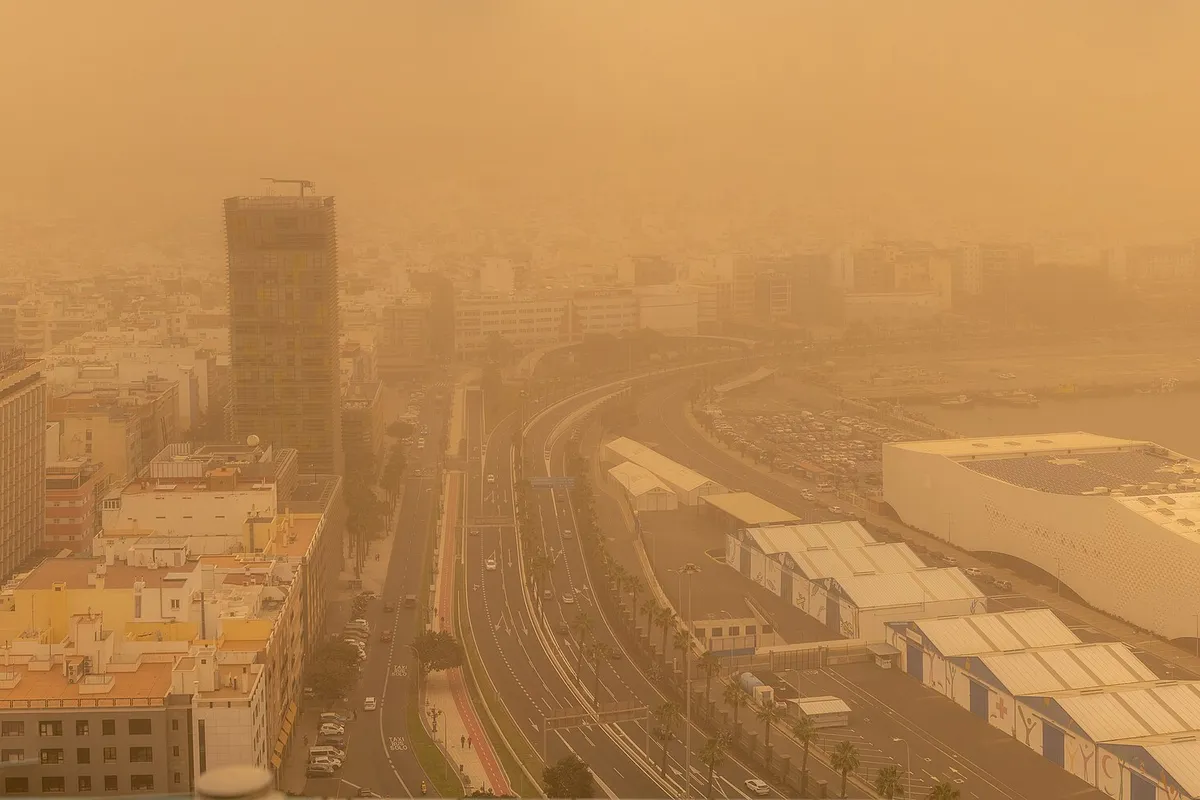
For drivers, calima means lower visibility and a dusty windshield: switch on dipped headlights, slow down, keep the windows closed and top up the washer fluid. Health officials advise avoiding strenuous exercise outdoors, especially for children, older people and anyone with asthma or a heart condition.
Rain loosens the slopes above the mountain roads, and the risk lasts for days, because the ground loses stability both as it soaks up water and as it dries. During storm Therese in March 2026, after a night of about 600 incidents, the Cabildo closed the TF-12 through Anaga and the TF-21 up to Teide and warned that the saturated slopes could give way at any time. On 1 November 2026 there were rockfalls along the TF-12 again.
In the Teno massif, a large rockfall closed the TF-445 to Punta de Teno on 29 October 2026. The TF-436 to Masca is narrow and winding with no shoulder. In January 2026, rockfalls closed the TF-82 at La Vetita, in Santiago del Teide, for about four weeks of emergency works.
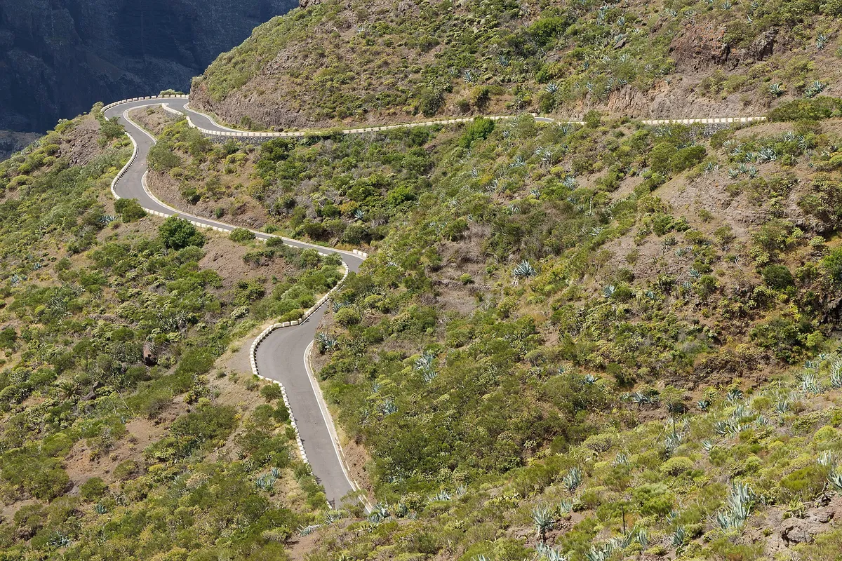
Gran Canaria’s summit roads are just as exposed: rain closed the GC-608 at La Culata de Tejeda and the GC-210 between La Aldea and Tejeda in January 2026, and storm Bruna closed the GC-200 between Agaete and El Risco on 9 November 2026.
On these roads, drive on a dry morning, never stop under cliffs, and turn back at any barrier, even if the road beyond looks clear. A small car is easier on tight bends, so an economy car in Tenerife suits Anaga and Teno best. Our Masca guide covers the TF-436.
Short days: in December the sun rises at about 7:40 to 8:00 and sets at about 18:10 to 18:20, Canary time. Be back on the main roads before dusk.
Snow on Teide: this season the first snow fell on 1 November. Last December, after snowfall, the park reopened to cars from 10:00 to 18:00 with a one-way loop in the north, and from 19 to 22 December private cars were banned and free shuttle buses ran instead. Our guide to driving to Mount Teide has the routes. Our guide to snow on Teide covers the road closures and shuttle buses in detail.
AEMET, the Spanish weather service, issues color-coded warnings by zone for rain, wind, coastal conditions, fog and dust:
The Gobierno de Canarias declares its own situations for each hazard and island: prealerta (pre-alert), alerta (alert) and alerta máxima (maximum alert). On 2 November 2026, La Palma, El Hierro and La Gomera were on rain alert, Tenerife and Gran Canaria on pre-alert. Each Cabildo, the island government, can also close roads, trails and ravines.
Before a mountain drive, check the AEMET warnings and the Cabildo’s road information: in Tenerife, the CIC road information center shows closures and live cameras, and the other Cabildos post closures online. 112 Canarias posts incidents during storms.
Yes. Most winter days are dry and mild. Problems come with storms, mostly on mountain roads, so check the warnings first.
Recent storms closed the TF-12 in Anaga, the Teno roads and the TF-82 in Tenerife, the roads up to Teide in snow and ice, and summit roads of Gran Canaria such as the GC-200, GC-210 and GC-608.
AEMET calls it significant danger. Keep to the main roads, skip mountain drives and hikes, and follow any closures. A red warning means avoiding travel unless necessary.
Put the V-16 beacon on the roof, get everyone to a safe place away from traffic, and call the rental company’s assistance line. The beacon calls no one; in an emergency, dial 112.
Cover photo: Fog on the TF-24 in Tenerife, on the way up to Teide National Park. Photo: Benjamín Núñez González, CC BY-SA 4.0, via Wikimedia Commons
 James O’Connor

 Luca Bianchi

 Oliver Thompson
 James O’Connor


 Carlos Ramirez


If the return time is later than the pickup time, 1 day will be added to the rental cost. Make pickup and return time the same.
 Camila Fernández
 Isabella Rossi